Monday, October 21, 2013

Upper Goose Pond Cabin Closes for the Season

Shutters ready for installation
We were able to re-open the cabin for a few days after the National Park Service resumed normal operations after the shutdown of the Federal government ended (more on this, below).

This past Sunday, we closed the cabin for the season as scheduled.  

What does this entail?  If you have owned or operated a vacation home of some sort, you pretty much already know.  We need to remove materials left over from the season's operations--especially things that will not survive freezing, or are attractive to mice and other small critters.  The second consideration is (regretfully) securing the building and equipment from vandalism or improper use.  For better or worse, the Cabin is pretty easily accessible by hunters, hikers and snowmobile riders over the winter.  In the "bad old days" people would break in (typically through windows), help themselves to firewood, leave a mess behind and not treat the surroundings with respect.  This has tapered off quite a bit as we've been steadily increasing the "difficulty factor" for people breaking in over the past several years.   

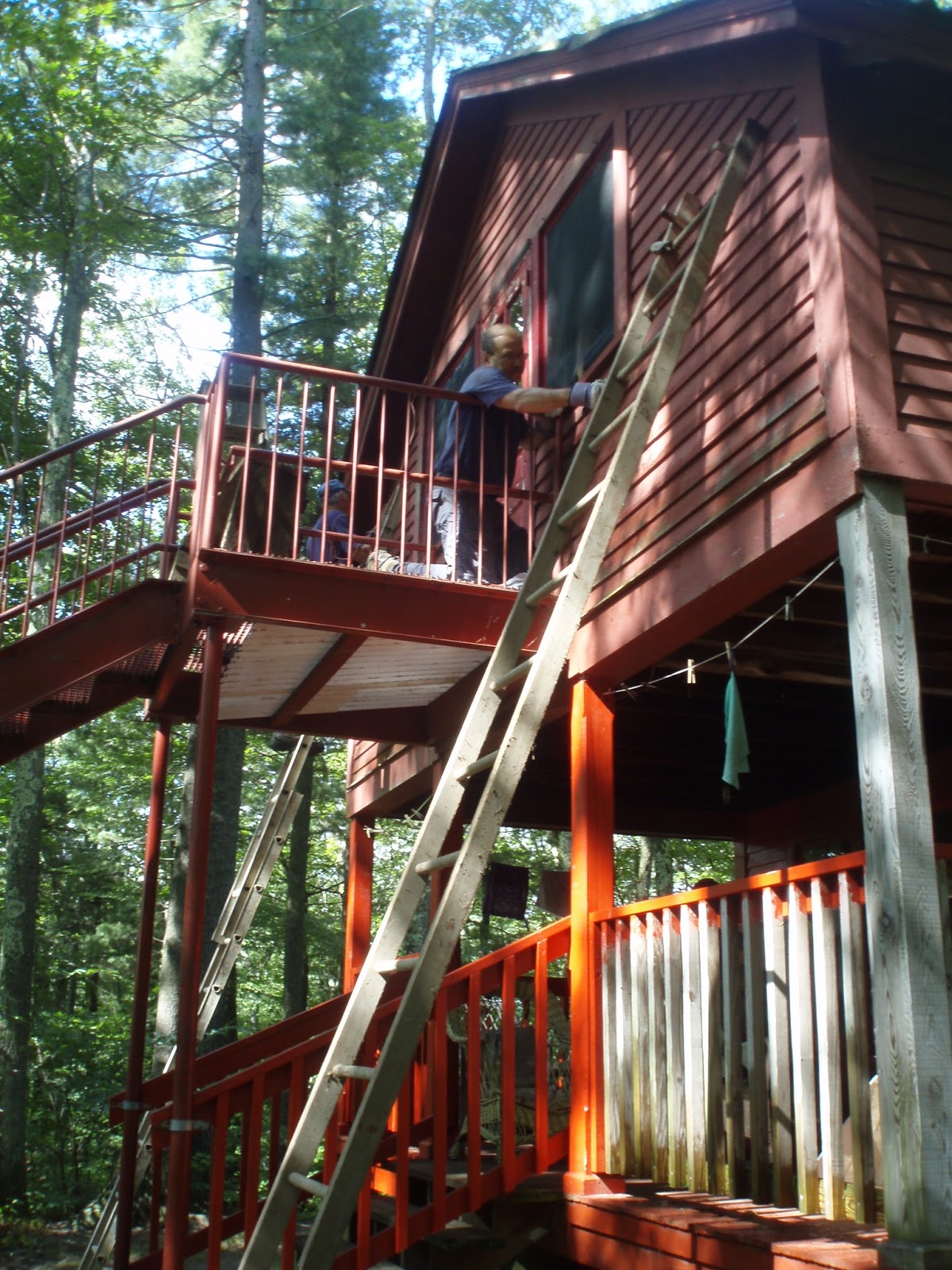
Pete bolts on a shutter
All buttoned up
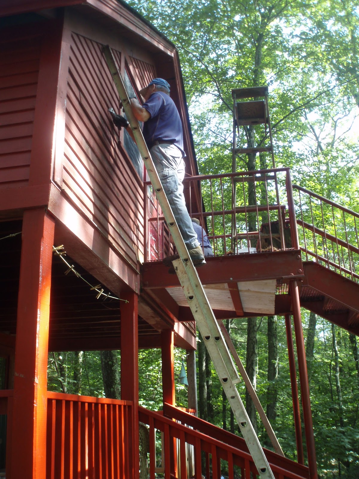
New shutters on front of bunkroom
Pete wades in to disconnect the floating dock.
Cabin closure is pretty much routine and consists of removing or securing in mouse-proof storage all the food and freezable liquids, storing the propane tanks away from the cabin, disconnecting the battery powered fire alarm system and installing wood shutters over the windows and doors.  

Pieces get stacked above the water line.
We also put the canoes into storage and finally, pull the dock out of the water.   This is a little easier late in the fall, as the pond is lowered over the winter to reduce the growth of weeds near the surface.  Still, it requires a bit of wading around the in chilly water, and at least four of us to get the heavy pieces above the water line.


While things are packed away, and the interior of the cabin is inaccessible,  the area is always open to visitors.  Tent platforms, privies, bear boxes and cooking areas are still available and ready for use--just like other overnight sites on the A.T.


 AT Committee members make regular winter time visits to check on conditions and perform ongoing minor maintenance.

Resting up for next year
About that "shutdown".  If the A.T. is managed by volunteers, what difference does it make if the government is in business or not?  National Parks are closed because there is no staff to operate them.  But the NPS APPA (Appalachian Trail Park Office) staff operates the AT indirectly with volunteers through ATC's 31 Trail Clubs.  The answer lies in some of the legislation regarding how Congress funds Federal agencies like the Park Service.  Seeking more information, I corresponded with Bob Proudman, ATC's Director of Conservation Operations. He said that it is our US government's legal interpretation of what constitutes closure under various national laws, principally the Anti-Deficiency Act of 1870, that prohibits volunteering.  As currently interpreted, this law stipulates that the government will not expend funds absent an appropriation from Congress or a resolution by Congress continuing a past appropriation (known as a "CR" or Continuing Resolution)

‘The Antideficiency Act prohibits federal agencies from obligating or expending federal funds in advance or in excess of an appropriation, apportionment, or certain administrative subdivisions of those funds. 31 U.S.C. §§ 1341, 1517(a). The act also prohibits agencies from accepting voluntary services. 31 U.S.C. §§ 1342." [Emphasis added].
It seems this is to prevent an agency from thwarting the intent of Congressional control by enlisting volunteers to do the work when Congress wishes the work not to take place.

While the footpath itself is pretty much impossible to close (except in more formally managed National Parks like Shenandoah or Smoky Mountains), facilities such as Upper Goose Pond Cabin (which is owned by the Park Service) are closed--even if staffed by volunteers.

So, there you have it.


Posted by Picasa

Monday, September 30, 2013

Another Day, Another Privy

September 28, 2013

They say whenever you get two or more AT volunteers together, the talk inevitably turns to S**t.   Managing human waste is an important part of what we do as trail managers.  Elsewhere in this blog, I've discussed why we just don't want people to camp anywhere they'd like.  The consequence of this is that when we concentrate use in a few locations (to preserve the rest of the Trail from impacts), we concentrate everything people do--from cooking to sleeping.  And people's byproducts are concentrated too.  

In some places on the AT (I'll refrain mention any specific places, but the state begins with a "T"), trail visitors are asked to "disperse" their waste and bury it in "catholes" about 6" below the ground's surface.  This works well for quick decomposition of the waste, but in an area around a shelter or campground, the available real estate for this activity is quickly used up--and not all hikers are skilled in making their deposits.  Add to this the intense traffic the A.T. generates and pretty soon the whole area around the shelter smells like an outhouse (well, it actually IS the outhouse).

The solution then, is to concentrate the deposition of waste in a place that does not impact the water supply, nor unduly degrade the hiking experience with odors and insects.  At most A.T. overnight sites in Mass (and now, elsewhere in New England) we have chosen to use "mouldering" type privies, where the waste is contained above ground and decomposed relatively quickly by aerobic bacteria and other critters.  At some overnight sites, where there is lower use, more room, and soils are easier to dig, we may choose to retain the traditional "Pit Privy".  Essentially a hole in the ground over which rests a toilet seat (and usually an small building to protect the user from weather and offer some privacy).

There are two problems with this: 1) The hole fills up. 2) The stuff does not decompose.  Burying waste in the ground slows decomposition, as oxygen-using organisms aren't present throughout the mass of waste.  Anaerobic critters take much longer to do their thing.  Old privy pits may remain essentially unchanged for years.

OK, enough talk.  In Mass, of 14 overnight sites we have three with pit privies.  About every 3-5 years, another pit needs to be dug and the old one covered with dirt.  This week it was Shaker Campsite.  Last dug in July of 2009, it was full pretty much to the top.

Step 1:  Pick spot for new hole.  This should be close to the current one, but not on top of an old hole or too far away (privies are heavy).  

Step 2: Dig the new hole.  We tipped the outhouse onto it's back so we could re-caulk the area where the vent pipe comes through the roof, and so some dirt from the new hole can be used to cap the old one.


Steve starts the digging

Don's turn to dig


Step 3: Keep digging.  The deeper the hole, the longer it will last.  Every shovel full of dirt we take out of the hole is 2-3 more deposits the hole will hold.  Eventually, the hole becomes so deep that the dirt can't be lifted out--about 31/2 feet deep is pretty much the limit.  The outhouse must completely cover the hole, so the hole measures about 3ft x 3ft.  The outhouse is 4ft x 4ft.
Steve is just about there

Not quite to China, but here's another 4 years of capacity


Don finishes up the caulking on the vent pipe.
Step 4: Move the outhouse.  No pictures here as all three of us were involved.  Important considerations: 1) Don't step into the old hole. 2) Don't step into the new hole.  Pile rocks on top of the cap of the recently covered hole to alert the next crew that this is not the place to dig a new one.


Friday, September 20, 2013

Nopel Patio Hardening

 September 14, 2013

Several of our shelters have a raised platform (or "patio") under the front overhang because of the slope of the ground where the shelter has been sited.  Picnic tables are placed under the overhang, not only for hiker's convenience, but to deter fires from being built directly in front of the shelter--so this patio needs to be reasonably level, pitched slightly for drainage.

Rock walls, or occasionally, wooden cribs are constructed, then filled with mineral soil taken from nearby borrow pits.  Because the patio is somewhat protected from the weather, the mineral soil never gets very wet and can be easily tracked into the shelter by hikers--especially when their boots are already wet.  Locations with sandy subsoils are particularly prone to this problem.  Earlier, we addressed the same issue at Wilcox South shelter  This post goes into a little more detail.

To remedy this, after the original patio has been used for a couple of years, we consolidate the mineral soil by mixing in cement and spread the mixture evenly over the surface and water it lightly.  The chemical reaction in the cement helps bond the dirt together creating a more durable surface.  Because the top coat has little structural strength, the soil underneath must be well-compacted. 

It starts with dirt.  Don harvests from the borrow pit.


3 parts mineral soil to one part cement.  Jim mixes small batches of the dry ingredients    


Dry mix is spread over well-compacted patio surface


Low spots are filled and lightly tamped with a rake


Jim and Steve use a screed board to make a smooth, flat surface


Surface is lightly watered


It sits for about a day while the mixture sets and dries.

Thursday, September 19, 2013

A Death on the Trail

Consider this an Op-Ed piece, these ramblings do not necessarily reflect the opinions of the Mass AT Committee, AMC, ATC or any of our Agency partners.


We had a hiker fall to his death on a side trail (which our Club maintains) to the AT this summer and there have been other fatalities elsewhere on the Trail this year that can be attributed to it’s physical challenges.  It brought to my mind that what we do is not without risk.  Our local story (in brief) occurred when a two brothers decided to hike down from Race Brook Falls campsite to “go check out the falls”.  They followed the blue-blazed trail down towards the road, and at some point (most likely where the trail turns left, away from the stream) went off-trail, past a line of large boulders and a double blaze placed to direct hikers to the left, and found themselves 50 yards later at the top of the waterfall.  From here, we as trail volunteers do not know what specifically happened next--we only know that one of the hikers fell down to the bottom of the upper waterfall.  Other hikers and local rescue personnel came to the scene, but were not able to save the man’s life.

So, this presents us a moment to think about some things:  As volunteer stewards we engage in many different aspects of trail management.  As well as physical maintenance of the trail, we write and edit the text in ATC’s guidebook, edit official maps, create and install trail signage, build bridges and construct shelters and privies at overnight sites.  What we can’t do of course, is get inside the head of trail visitors--we can only supply as much external information as we can--while keeping the hiking experience as “wild” as it can be.  As our AT Management Plan puts it:
“[Trail facilities]..should be constructed when appropriate to protect the resource or provide a minimum level of public safety. Design and construction of these facilities should reflect an awareness of, and harmony with, the Trail’s primitive qualities."

Just what is our personal risk in “providing a minimum level of public safety?”  A.T. volunteers are protected from Tort by the Volunteers in Parks program run by the NPS.  Club volunteers are considered “government employees”, and as such can’t be sued by hikers for injury, inconvenience, lost time, etc, as long as they are working within their job descriptions (part of which is reflected in the Management Plan quoted above).  

While we are protected--it does not remove our responsibility to do things the right way--follow design standards and maintain the physical condition of the trail as required by ATC.  We do all those things (and do them well), and still a hiker dies of his injuries.   Should/Could we do more?  Would railings or fences built to keep hikers on the trail or away from cliffs be in harmony with the Trail experience?  Should we build ATV-accessible “rescue routes” from nearby roads to the A.T., put mile markers on the blazes, and clear helicopter access openings in areas where there are higher numbers of hiker injuries and/or rescues?  We get these requests from local responders often when there is an incident on the Trail, but so far have not been required to provide them as they are not part of the standard we are required to follow.  

A hiker takes on a level of personal risk by choosing to hike the Trail--but I think, sadly, they are not always aware of that assumption.  Ultimately, they are responsible for their own actions.   There are going to be slippery rocks, muddy trail, unsigned road crossings or trail intersections, unprotected cliffs, even a scarcity of blazes.   When a hiker steps out of the parking lot and onto the AT she immediately enters a world where the “golden hour” that EMT’s value so much (the time between injury and the hospital) does not exist.  For some of us, that is part of the appeal of the Trail--the breaking of bonds between the protective shell of the “real” world and the freedom of the trail world.  I believe we should continue to avoid pressure to make the A.T. a “walk in the park”, to diminish the sense of remoteness and distance from the built world.   But, are we really ready for the consequences?  I think we did everything right regarding the physical condition and management actions on the Race Brook Falls Trail,  but I am thankful that it was not my son laying at the bottom of Race Brook Falls.

Wednesday, August 28, 2013

A New Roof for North Wilcox Privy

Working on privies  is never a pleasurable project, but they do need maintenance and care from time to time, so.......early this week our small crew headed to North Wilcox to replace the roof.  The roof on this privy had several holes in it and was generally in poor shape.  Also, the roof panels used barely covered the roof resulting in rotted fascia boards at the roof edges. 

We decided to nail short 2X4's to the front and back of the privy so we could tip it over on it's side making access to the roof easy. 

 
After removing the old roof, which took all of about 5 minutes, we built an extended roof structure from 2X4's to make the roof slightly larger affording more protection to the sides of the privy.  After nailing on the new fascia boards it was time to cut the hole in the first new roof panel to go around the privy vent.


Above Don screws the first panel down after much fiddling with the hole for the vent.  These fiberglass roof panels are not easy to cut but we finally made a satisfactory job of it and gooped up the join where the vent passes through the roof panel.  The rest of the roof panels went on easily with a minor problem to deal with.  We did not buy enough of the wood closure strips which are laid under the paneling to match up the corrugated underside of the panels with the flat 2X4 roof framing.  We solved this problem by leaving the bottom left side of the new roof unsecured.  It will be a quick job to return with the necessary closure strip and a screw gun finishing the job. 
 
 
With Silvia starting the painting we finished the roof job before tipping the privy back upright.
 
 
Here you see the nearly finished job which was shortly done and open for business.  It was a full days work so we packed up our tools and the old roofing and headed back to our vehicles.  The day held one last surprise.  We noticed a rather friendly hawk hanging out where the AT crosses Beartown Mtn road on our way into the project in the morning.  He (she?) was waiting for us on our return and even let me get a picture:


And so ended another great day of fun in the woods!  Checkout our Project Schedule https://docs.google.com/spreadsheet/ccc?key=0AvNh0IsoVlxpdHkyWG1iUmpuZV9uSGw5TU53d0xWYlE&usp=sharing for upcoming events and join us if you'd like.

Sunday, August 18, 2013

Upper Goose Pond Cabin Maintenance

August 10, 13, 17 and 24.

The NPS-owned cabin on Upper Goose Pond is a much-anticipated stop for all visitors on the AT in Mass--and a few locals as well.  Overseen by volunteer caretakers who work weekly shifts, this building has no electricity or running water--and no road access.  A small propane stove and rudimentary kitchen provide for the needs of the caretakers--hikers still must bring and prepare their own food and sleeping gear (a bunkhouse on the 2nd level accommodates about 16 sleepers).  There are also two tenting areas adjacent to the cabin.

The cabin sits above the rocky shore of Upper Goose Pond.  A pristine, undeveloped pond (perhaps the last one in Massachusetts?) surrounded by land purchased in 1982 to protect the AT.   The pond has hosted both moose and bald eagles in recent years.

Dave paints from the fire escape
Although the structure is owned by the National Park Service, it is maintained and operated by our Trail Club (AMC Berkshire Chapter's AT Management Committee), completely with volunteer labor and management.  It hosts around 600 overnight visitors per season, plus many more day users.  

Keeping the cabin and the few outbuildings in good shape and in safe operating condition is another responsibility we happily undertake.   This summer we installed new roofing and siding on two small sheds as well as continuing with the "one side per year" painting schedule for the main cabin.


Don works the SE corner
Pete finishes the railings
 Although extensive by comparison to typical AT overnight sites, the AT Committee works hard to maintain a sense of remoteness at the cabin that is consonant with the AT experience.  The temptation to make "improvements" (easier access to drinking water, better lighting, interior finishes, etc) is constant, and must be resisted--else the cabin becomes a "town stop" instead of a singular overnight experience for the AT traveler.

Pete and thru-hiker Atlas install rafter extensions on the woodshed


Don gets roof duty.

The final pieces of water shield on on.  They will be covered with red metal roofing.

Field Clearing--Goose Pond Rd and Tyringham Valley


Tuesday Aug 6-Thursday Aug 8

This week we put together a team of trail volunteers, ATC staff and a trail neighbor to perform some field maintenance on properties near the AT.   While the AT does not run through these fields, it does run adjacent to them and they form an important part of the view hikers have as they traverse the countryside. 

Silvia gets ready to attack
Definitely the right tool for the job.  ATC's new tractor w/ brush hog
Open fields, particularly in valleys, are a part of the "New England vernacular landscape".  It's the visual picture that to some extent defines what the area looks like--at least in our present sensibilities.  Of course previously, before Europeans began to define the land, it was mostly forested with open areas created by natural causes (beaver
meadows, for example) or areas opened by the indigenous inhabitants (aka "Indians").

Once Europeans became a permanent presence, the forest steadily diminished, and open country became the predominant landscape.  Images of southern New England from the latter part of the 1800's show almost no forests, even on the mountains.

In Massachusetts, since the mid 1850's, the land that was originally in agriculture, and later in pasture, slowly began to become re-forested as farming became less profitable and populations began to congregate in the cities and towns--where the jobs were.  Today, Massachusetts has more forested acres than it has had since the Civil War.

So back to the Trail.  As the footpath was moved off of roads onto protected lands, some of that land was being actively farmed or otherwise recently in agriculture, especially in valleys.  Both to preserve the current Trail landscape as part of the "nationally significant scenic, historic, natural, or cultural qualities of the areas through which the Trail passes"   (from the NPS AT Strategic Plan), we try and maintain these traditionally open spaces.  One way is via a Special Use Permit (SUP).  This is an arrangement with a farmer to keep the land (possibly purchased from him for the Trail) in agriculture.  He (or she) pays a small fee to the Park Service, is able to farm the land, but is not responsible for paying property taxes on those tracts.  In other places, the land may have simply been purchased as open land, and the local Trail Club decides whether  to maintain it as open, or let natural succession take place--eventually resulting in more forested land.
How tall was the grass?  Steve running the tractor/brush hog .

So that's a (very) long-winded way to say we need to mow to keep these particular parcels open--to maintain the landscape in it's current form.  Therefore, we devote several project days a year to this effort, assisted by ATC staff and equipment as well as the Club's own field mowers.

Smaller mowers are used around the edges and obstructions.
The DR is challenged by this much growth.


The Giant Machete does a little better
Out of the Green Tunnel.  AT passes through the gate in the center of the photo.
We mow late in the summer after birds are finished nesting and most of the plants have set seed.  This is an ongoing part of maintaining the Trail in both Mass and CT--and likely other states as well.


Monday, August 5, 2013

Rt 7 Bridge, Day 3

Rt 7 Bridge--Completed

August 3rd, 2013

With an experienced crew of 8 bridge builders we wrapped up the project today.

Pete and Christine start planking on the south end
We arrived on site to find the timbers as we had left them spanning the stream.  We attached them to the sills and began to install the blocking and deck planks.  Because the beams were slightly warped, we used a bar clamp to align them as we inserted the blocking in the space between the beams. 
Dave and Steve start on the north
This blocking serves several functions:  it helps share the load among all three timbers,  maintains equal space between them and most importantly, because the beams are relatively narrow for their depth, keeps them from twisting under load. 
The careful layout and installation of joist hangers on previous project days paid off, as we had little trouble inserting the blocking.

Kneeling on temporary planking, Pete and Dave drive the "golden spike" in the middle of the span
The bridge seems strong enough
While the blocking and planks were being installed, four 6x6 posts were set into the ground, two at each end of the bridge.  These are intended to keep the bridge mostly in place should it ever be floated off the ground by flood waters.  This area sees water up to two feet above the trail--particularly in the spring.   When this happens, hikers are routed onto adjacent roads until the water subsides, usually in a day or two.
Our greatest concern would be to find the bridge had been floated so far out of location that one end dropped into the stream--the thing is so heavy we would not likely be able to pull it back into place w/o heavy equipment.


Bob and Don attach railing posts


Adding railings to the bridge completed this phase of the project. 
While most AT bridges in Mass don't have railings, for this long span and deep ravine, railings seemed like an appropriate measure.
Our first official customers.  Two Northbound thruhikers

The final phase was the demolition and removal of the old bridge.  Using a rock bar, we were able to easily pry the planks from the the 8x8 timbers.
Steve removes nails from the old bridge planks
Timbers were unbolted from their posts on the north end and using the comealong--with some effort--we were able to drag them over to the south bank.  The timbers were cut in half for transport back to the tool shed.
Don operates the comealong to drag the old timbers ashore
We then cut up the portions that were not rotting, and will use them for bog bridge base timbers on a project happening later in the month.

From identifying the problems with the old bridge (rotting support beams and a widening stream bank), to completion this past week took almost two years.   Along the way, we were early users of ATC's new bridge policy, applied for and received approvals from the Sheffield Conservation Commission and the National Park Service, and paid for about half the materials through an LL Bean Grants to Clubs program.  Total cost for this project was about $2000.  Volunteer hours for construction totaled 138.  Planning hours are harder to figure, but are probably around 100.  During construction, we had the pleasure of working with staff from ATC's New England Regional Office and the Mass Department of Conservation and Recreation's AT Ridgerunners.  Special thanks to Bruno's Dog House for letting us use their hose to wash off with poison ivy soap after each day of construction.

Open for business.  Note the posts at the ends to reduce the tendency for the bridge to float away

Looking Northbound


Thursday, August 1, 2013

Rt 7 Bridge--Day 2

July 30, 2013


Today was about getting the previously assembled beams across the stream and fastened in place. 
Sill work, beams in background


Dave and Jim setting sills
We finished up the sills for the bridge to rest on and on the beams, laid out and attached the joist hangers for the internal bracing.

Denis finishes up sill bearing plates.


One at a time, each 500lb beam was then slid from the assembly area and pivoted to align with the sills before being sent across the stream. 
Dragging a beam into position for launching.
This was probably the most difficult part of the day, as the ground was not particularly even, and the 36ft pieces were heavy and cumbersome.  Next time, we'll bring some rollers to ease this process.

To keep the beams upright and horizontal on their way to the far bank, we installed a piece of 1/4" wire rope across the stream to carry the front end.  This wire was 75 ft long, attached to a tree on the south side, and to a post we installed in the corn field as the anchor on the north side.   To support the 250lb end of the beam in the center of such a long span, this wire needed to be very tight.  We used two 1/2" diameter turnbuckles to tension the wire until the post began to shift slightly in the ground.  A bracket was attached to the front of the beam to hold a pulley that traveled along the wire.

Beam #1
Beam #2 starts the journey
With most of the team lifting and pushing from the north side, the beam was slid over the sill and out over the stream. 

As the beam approached the south bank, two people lifted and pulled the beam up and over the sill.

Once all three beams were across, they were set in their final locations and screwed to the sills with timber screws.


First beam landed
All 3 beams in place and ready for planks
On our next (and hopefully final) day on the project, we'll work our way out along the three beams installing blocking and deck planks as we go.  Then a railing will be set in place and the old bridge taken apart and removed from the site.